A Chinese military drone operating over the South China Sea since at least August has been systematically broadcasting false aircraft identification codes, causing it to appear on public flight-tracking systems as a succession of unrelated aircraft, including a sanctioned Belarusian cargo jet, a Royal Air Force Typhoon fighter, a North Korean passenger plane, and an anonymous executive jet, in what regional diplomats and open-source intelligence analysts say represents a new and deliberate form of aerial deception that may be rehearsing tactics for use in a potential conflict over Taiwan.
At least 23 flights have been logged under the call sign YILO4200 since August, according to an analysis of data from flight-tracking platform Flightradar24. Throughout those operations, the aircraft broadcast identification codes belonging to entirely different registered planes rather than its own transponder signal. China’s defence ministry did not respond to questions about the flights or their purpose.
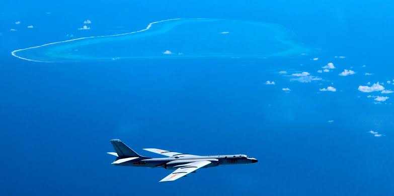
The aircraft has been identified by four open-source intelligence analysts, including Ben Lewis, founder of the monitoring platform PLATracker, as a Wing Loong 2, a large, long-endurance unmanned aerial vehicle produced by the state-linked Chengdu Aircraft Corporation, a subsidiary of the Aviation Industry Corporation of China.
The Wing Loong 2 has a wingspan of 20.5 metres and is comparable in size and function to the United States military’s MQ-9 Reaper drone. It is designed primarily for surveillance but can be configured for precision strike operations, command and control functions, and anti-submarine warfare. Chengdu Aircraft Corporation said it would not comment. The identity of the Chinese government agency directing the flights out of Hainan’s Qionghai Boao International Airport, a dual-use civilian and military facility, has not been established.
What distinguishes the YILO4200 operations from routine military drone activity is not the locations flown or even the surveillance patterns traced, but the layered deception embedded in the transponder data.
Aircraft registration numbers are governed by a 24-bit address system administered by the International Civil Aviation Organization, with each code uniquely assigned to a specific aircraft and broadcast via transponder to convey position, direction, and speed. These addresses are publicly accessible.
The drone’s most frequent disguise has been an Ilyushin Il-62 cargo aircraft operated by Belarus-based Rada Airlines, a carrier sanctioned by the United States Treasury’s Office of Foreign Assets Control in August 2024 for transporting Wagner Group personnel across Africa and for involvement in exotic wildlife trafficking.
The choice of a sanctioned operator as cover identity has drawn particular attention from analysts. On at least one occasion, in November, the Wing Loong 2 was transmitting the Rada Airlines registration code while the actual Belarusian aircraft was simultaneously airborne near Belarus on a separate flight path, meaning both the drone and the real aircraft appeared on tracking systems under overlapping identities at the same time.
Two flights among the 23 reviewed were especially unusual in their technical execution. On the night of August 5 to 6, the drone initially transmitted a code registered to the RAF Typhoon, then cycled through three additional aircraft identities over roughly 20 minutes before landing under the Rada Airlines signature. The sequencing suggested active, real-time switching rather than a fixed pre-programmed identity. Flightradar24 Communications Director Ian Petchenik said the platform had not previously encountered such patterns beyond occasional accidental miscoding or corrupted data.
“Based on the flight patterns and the kind of usage of these 24-bit addresses, it doesn’t seem like it is a mistake in the programming of the transponders,” Mr. Petchenik said.
The operational geography of the flights adds a further layer of concern for regional security officials. Flight paths from Boao Airport ran east toward the Philippines near the disputed Paracel Islands and south along Vietnam’s coastline, passing through areas of concentrated naval activity and covering waters frequented by submarines. The eastern trajectories brought the aircraft toward the Bashi Channel — the narrow strait between the southern tip of Taiwan and the Philippine island of Luzon — which serves as a critical maritime passage for Chinese naval vessels seeking access to the western Pacific. When the 23 logged flight paths are overlaid on a map of Taiwan rather than the South China Sea, the routes pass through multiple points of military significance, concentrated around Taipei but extending the length of the island’s southern coastline and approaching Japanese and United States installations in the Ryukyu island chain, including Okinawa.
Read Also: Iran Nears Deal For Chinese Supersonic Anti‑Ship Missiles
Singapore-based security analyst Alexander Neill, a fellow at the Pacific Forum in Honolulu, said the pattern pointed toward something more purposeful than training exercises.
“They don’t appear to be exercises as much as the kind of action the U.S. Indo-Pacific Command has described as rehearsals for a confrontation, anything the Chinese can do to sow confusion in the minds of their rivals is to their advantage,” Mr. Neill said. He added that in automated high-speed conflict environments, even brief delays caused by false identification data could carry tactical consequences.
“The U.S. and its allies know that given the realities of highly automated conventional conflict, even milliseconds count along the kill chain of escalation.”
Mr. Lewis of PLATracker was unambiguous about the intentional character of the operations. “It’s a kind of deception trial being carried out in real time using aircraft that are not exactly low profile,” he said. “It does not appear to be at all accidental.” The assessment was shared by three regional diplomats, four open-source intelligence analysts, and three security scholars who reviewed the flight data independently.
Analysts were careful to note that the tactic’s practical value against sophisticated military radar systems and professional air traffic controllers is limited. Military-grade radar does not rely solely on transponder data, and experienced controllers can cross-reference multiple signals to identify inconsistencies. The more significant application, analysts suggested, would be in sowing time-consuming confusion at the margins of a conflict, concealing the true nature of sensitive surveillance missions, or generating material usable for propaganda or information operations against civilian or government audiences.
The Wing Loong 2 typically flies without transmitting any signal at all — operating what is described in aviation and military monitoring communities as flying “dark,” with neither call signs nor registration numbers broadcast. The deliberate decision to transmit false rather than no identity makes the YILO4200 operations a departure even from standard Chinese military drone practice.
Read Also: Ex-USAF Pilot Charged With Training Chinese Armed Forces
Since mid-December, the same aircraft has conducted additional flights over northwest China, most recently on February 15, during which it transmitted the identity of a Pilatus PC-12 — a small Swiss-built turboprop typically used for light passenger transport. Whether those inland flights serve a related purpose or represent a separate line of operational testing has not been determined.
No government has formally lodged a diplomatic protest over the flights, and no public response from the Philippine, Vietnamese, or Taiwanese administrations had been issued as of the time of publication.