State-aligned media and propagandists exploited artificial intelligence tools to fabricate satellite images purporting to show bombed military installations during the first week of fighting between Iran and the United States, fooling millions of social media users and exposing vulnerabilities in how wartime information spreads across digital platforms.
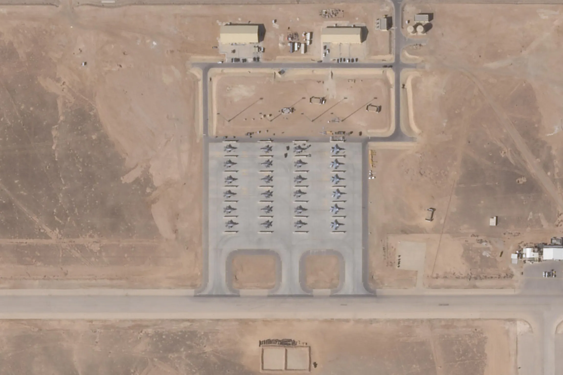
Tehran Times, an English-language daily aligned with Iran’s government, posted what it claimed was before-and-after imagery of “completely destroyed” US radar equipment at a base in Qatar.
Researchers determined the photo was an AI-manipulated version of a Google Earth image from last year showing a facility in Bahrain, with identical cars parked in the same positions in both versions—a clue that escaped viewers who shared the fabrication millions of times.
Information warfare analyst Tal Hagin flagged another AI-generated image suggesting Israeli and American jets had struck painted aircraft silhouettes on the ground in Iran while Tehran moved real planes to safety. That fake included gibberish coordinates and carried SynthID, an invisible watermark meant to identify content created using Google AI.
Brady Africk, who tracks open-source intelligence, said manipulated satellite imagery has surged on social media following major events including the Middle East war. Many fakes display telltale signs of imperfect generation—odd angles, blurred details, features that don’t align with reality. Others appear manually edited, with damage indicators superimposed onto authentic satellite photos.
“Manipulated satellite imagery, like other forms of misinformation, can have real-world impacts when people act on the information they come across without verifying its authenticity,” Africk said. He warned the effects range from swaying public opinion on whether countries should engage in conflict to disrupting financial markets.
The fabrications follow emergence of imposter accounts on platforms like X, Instagram and Threads that mimic credible digital investigators while spreading falsehoods.
Hagin said the fog of war makes assessing enemy strike success difficult, a gap open-source intelligence once filled by analyzing public satellite imagery to circumvent censorship inside countries like Iran. “But it’s now being preyed upon by disinformation agents,” he said.
Generative AI has turbocharged the ability of state actors and propagandists to produce convincing fake imagery during conflicts, a development researchers say carries security implications beyond influencing public perception. Users increasingly fail to distinguish reality from fiction on platforms saturated with AI-generated visuals, even when subtle giveaways exist.
Read also: Iran’s New Chief Needs My Say-So To Survive, Trump Warns
Similar patterns emerged during Russia’s war in Ukraine and last year’s four-day conflict between India and Pakistan, where reports surfaced of satellite imagery created or edited using AI to misrepresent battlefield conditions.
Authentic high-resolution satellite imagery collected in real time can give decision-makers vital information to assess threats and counter misinformation from unverified sources, particularly as AI-generated fakes grow more sophisticated.
Satellite intelligence company Vantor used its own imagery to confirm that photos purporting to show Niamey airport’s main civilian terminal on fire during a recent militant attack in Niger were fabrications, almost certainly generated using AI.
Tomi Maxted from Vantor told AFP the company detected the fakes circulating online and deployed its satellites to establish ground truth.
Bo Zhao from the University of Washington said satellite images presented as visual evidence in war contexts can easily shape how people interpret events. As AI-generated imagery becomes increasingly convincing, “it is important for the public to approach such visual content with caution and critical awareness,” he said.
The Tehran Times image spread across multiple languages despite forensic clues that should have raised suspicions. The identical car positioning suggested the “after” photo was digitally altered rather than captured following an actual attack. Other anomalies included lighting inconsistencies and artifacts typical of AI generation tools.
Whether platforms can develop systems to detect and label AI-generated imagery before it spreads remains uncertain. Current watermarking techniques like SynthID are invisible to casual viewers and easily removed by users determined to pass off fabrications as authentic.
The challenge intensifies as AI models improve. Early-generation fakes often contained obvious errors—distorted faces, impossible physics, nonsensical text. Newer systems produce imagery sophisticated enough to fool even trained observers without forensic analysis.
Read more: Iran’s New Chief Needs My Say-So To Survive, Trump Warns
Commercial satellite companies including Maxar, Planet and BlackSky provide imagery used by governments and media organizations to verify claims during conflicts.
Their products carry metadata proving when and where photos were captured, though that authentication matters only if users know to check it.
The proliferation of fake satellite imagery complicates efforts to hold combatants accountable for strikes on civilian infrastructure or protected sites. If fabricated images muddy understanding of what actually happened, war crimes investigators face additional obstacles documenting violations.
Financial markets have proven vulnerable to misinformation spread through manipulated imagery. False reports of attacks on energy infrastructure or military installations can trigger price swings in oil, defense stocks and currencies before corrections emerge.
Zhao and other researchers have called for public education campaigns teaching digital literacy skills that help people spot AI-generated content.
But the arms race between detection methods and generation capabilities tilts toward those creating fakes, who can iterate rapidly while verification systems lag behind.
The Tehran Times has not acknowledged the satellite image it published was fabricated or corrected its initial claims about destroyed US equipment in Qatar. The post remains visible on X, where it continues accumulating views and shares despite researchers debunking it days ago.