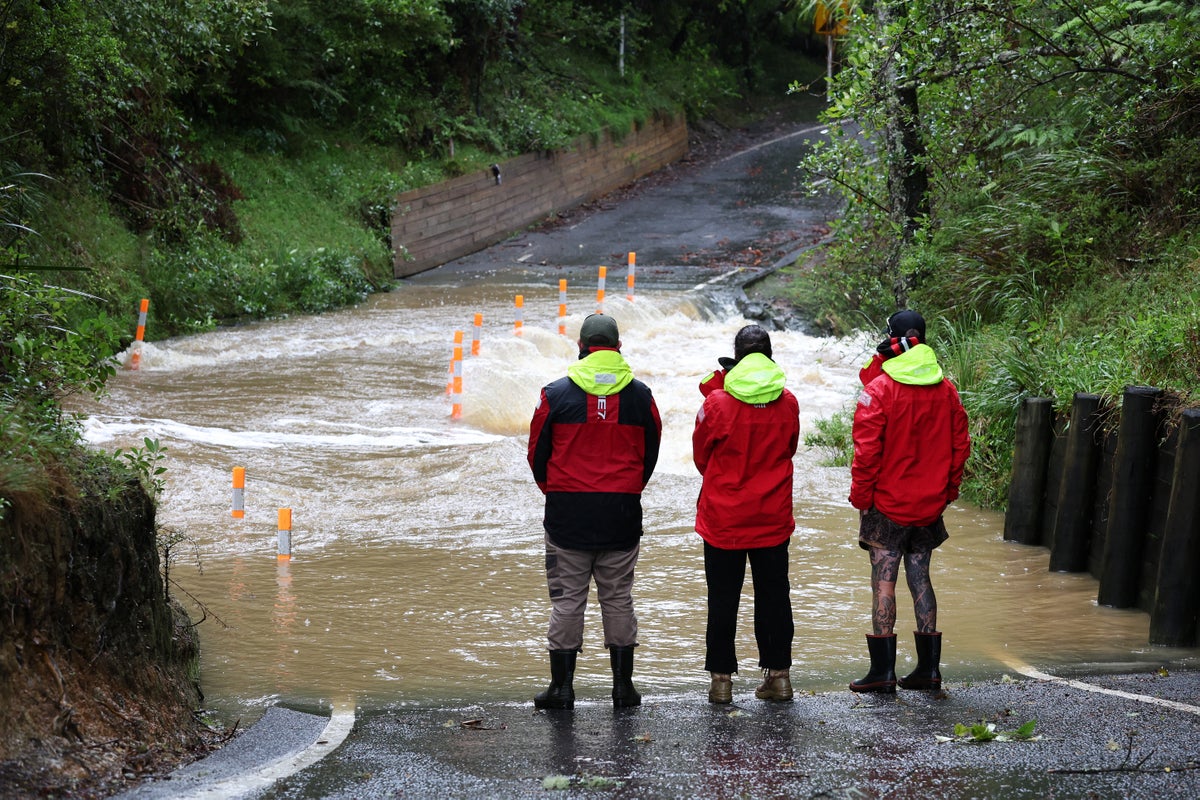
Wellington declared a state of emergency Monday after record rainfall overwhelmed the New Zealand capital overnight, flooding homes, triggering landslides and sending emergency crews across the region on more than 150 callouts as authorities warned a second weather system was already moving in.
The city received 77 millimetres of rain in less than an hour — the heaviest single-hour rainfall ever recorded in Wellington — with some suburbs absorbing up to 22 millimetres in short, concentrated bursts that stormwater infrastructure had no capacity to handle. Roads closed. Vehicles were submerged. Residents in low-lying areas were asked to evacuate. Schools shut across the region.
Mayor Andrew Little said he had “never known anything like” what hit the city overnight. “A lot of that flooding was the stormwater system being overwhelmed,” he said in a social media address, urging residents to avoid unnecessary travel and warning that surface flooding persisted in multiple areas even as some of the worst effects began to dissipate. A man went missing from the suburb of Karori after last being seen on a flooded property, prompting a search operation.
Read also: Iran Withdraws From 2026 World Cup As War With US Continues
Fire and Emergency New Zealand activated its regional coordination centre to manage the escalating response. Deputy national commander Megan Stiffler issued a direct warning to residents tempted to test the floodwaters. “Floods and flash floods can happen quickly. If you see rising water, do not wait for official warnings. Do not try to walk, play, swim, or drive in floodwater. You are putting yourself at risk, and risking the lives of those who come to your rescue.”
The state of emergency declaration gives civil defence authorities expanded powers to coordinate evacuations, direct resources and manage infrastructure impacts across the region. Wellington Civil Defence Emergency Management Group joint committee chair Anita Baker said the declaration was necessary given the ongoing and evolving nature of the risks. “The state of emergency gives responders the powers and coordination needed to keep people safe, support evacuations where required, and manage impacts across the region,” she said.
Scientists were quick to explain the mechanics behind the flooding. Dr Emily Lane, chief scientist for flooding and extreme weather at Earth Sciences NZ, said the event was a classic case of pluvial flooding — rainfall so intense and localised that urban surfaces, which cannot absorb water the way soil can, simply channelled it overland when the stormwater network reached capacity. She added a warning about the trajectory of such events. “Short and relatively localised but very intense events like those we have seen over the past few days are the type of event expected to increase the most with climate change.”
The heavy rain warning covering Wellington and the Wairarapa region remains in place until Tuesday night. Meteorologist Katie Lyons said the preceding days of severe downpours had already saturated the landscape and that forecast rainfall would compound the risk. “There is an increased threat to life from dangerous river conditions, significant flooding and slips, with especially hazardous driving conditions,” she said, adding that some roads could become impassable and cut communities off entirely. Dangerous sea conditions were also forecast along Wellington’s south coast.
Little warned that the day was not yet over. “We’ve had flooding, slips and evacuations. There’s another big weather system moving in this afternoon, so we need to just stay alert and be prepared,” he said. “I’m taking this very seriously, and so is our whole region.”