China is working hard to map huge parts of the ocean floor. According to a new report from Reuters on March 24, 2026, Chinese research ships are collecting detailed information about the seabed in the Pacific, Indian, and even parts of the Arctic Ocean.
Experts say this mapping could help China’s submarines move more safely and hide better if there is ever a conflict with the United States or its allies.
One ship that has been very busy is called the Dong Fang Hong 3. It belongs to Ocean University of China. Tracking data shows this ship spent a lot of 2024 and 2025 sailing back and forth in important ocean areas.
It has been near Taiwan, close to the U.S. military base on Guam, and along key shipping routes in the Indian Ocean. The ship has also checked on underwater sensors near Japan and made many criss-cross patterns in sensitive waters.
Read also: China Ties Taiwan Energy Offer To Reunification
China is using many ships like this for the job. They drop special sensors into the water to measure how deep the ocean is, the temperature of the water at different levels, how salty it is, and the direction of the currents. All this information helps submarines know exactly where they are, where they can hide, and how to avoid being found by enemy ships or planes.
A U.S. Navy officer, Rear Admiral Mike Brookes, recently told Congress that China’s ocean mapping is a serious concern. He explained that the data helps Chinese submarines navigate better, stay hidden, and even place underwater listening devices or weapons on the seabed.
This isn’t something new. China has been building what some people call an “Underwater Great Wall”. A big system of sensors on the ocean floor, especially in the South China Sea. The more they know about the shape of the seabed and the water layers, the easier it is for their submarines to move quietly and the harder it is for American or other countries’ submarines to sneak around without being detected.
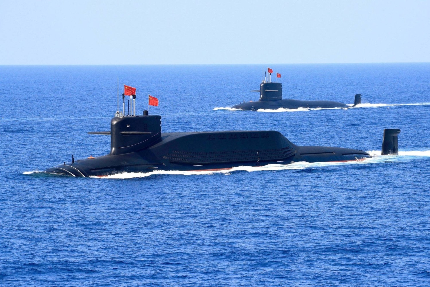
Submarines are powerful and super important in modern navies. They can stay underwater for weeks or months completely undetected. Good maps of the ocean floor are like having a secret GPS underwater. They help captains choose safe routes and good hiding spots. That’s why countries spend so much time and money studying the seabed.
China says most of this work is for scientific research and deep-sea exploration. Some of the ships are also looking for valuable minerals on the ocean floor. But the pattern of where the ships go, especially near important U.S. bases and busy shipping lanes, has caught the attention of military watchers in the United States and other countries.
Read also: China Widens BHP Iron Ore Curbs To Flagship Pilbara Products
The United States has had the strongest submarine force for many years. American subs are very quiet and hard to find. China is racing to catch up, so it is growing its own submarine fleet quickly and learning as much as possible about the oceans.
Right now, Chinese ships continue to map large areas of the sea. This is part of a bigger plan to make China’s navy stronger, even far away from its own coast.
While no one knows for sure what will happen in the future, this careful mapping shows how seriously both China and the U.S. are taking the underwater part of any possible future conflict.
The story is still going on as more ships keep collecting data and experts keep studying what it all means. What is clear today is that China is building a much better picture of what lies beneath the waves and that picture could be very important for naval strategy in the years ahead.